Close-ups
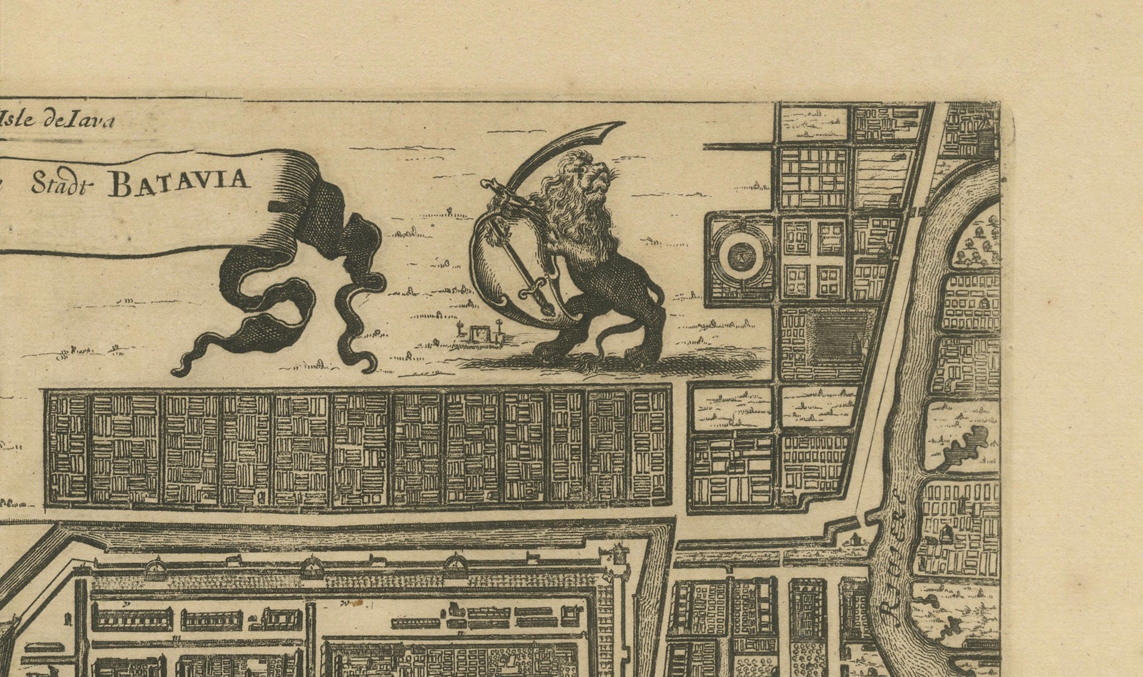
Framed and on the wall
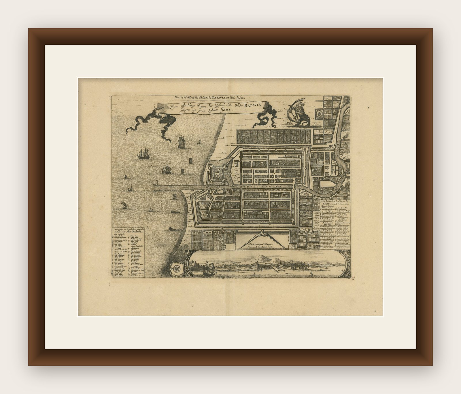
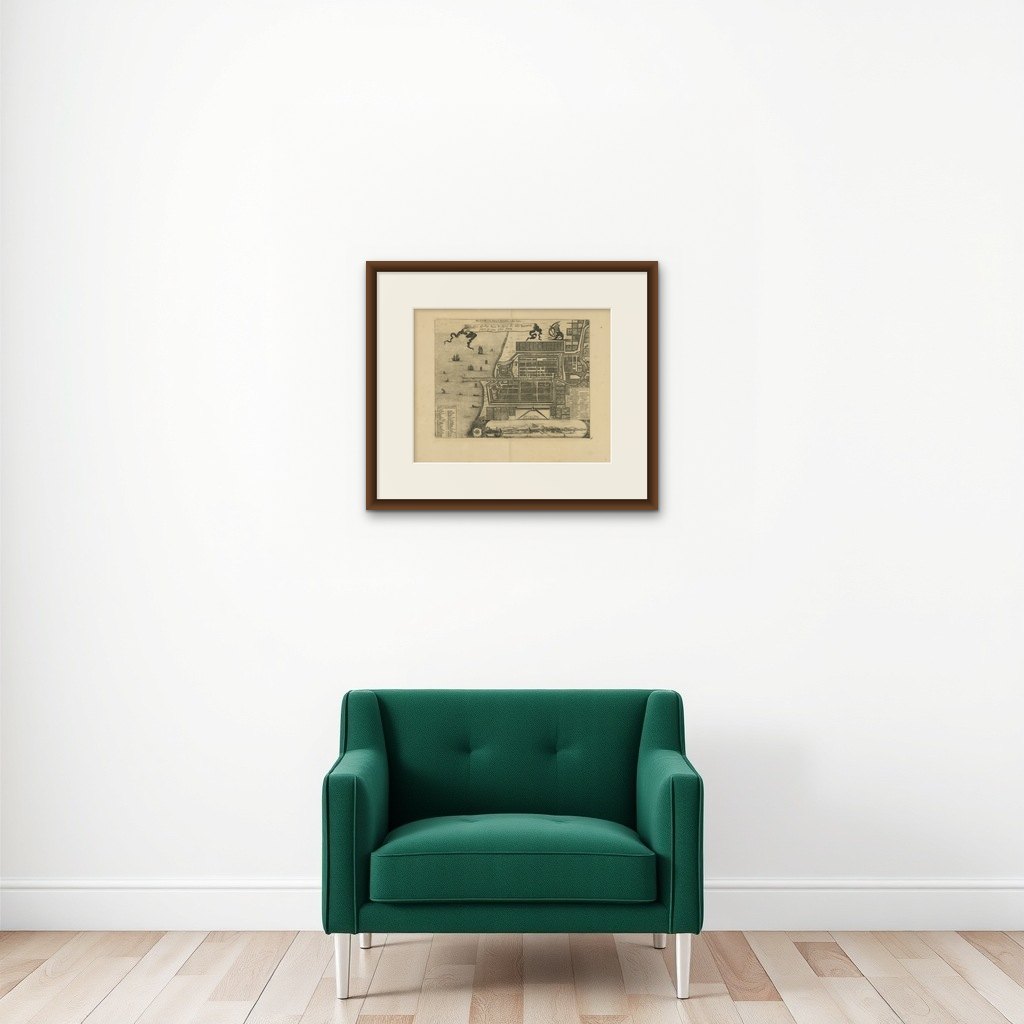

Frame and rooms are illustrations of how the print could look, drawn to its real size; it is sold unframed unless the description says otherwise.
Maps and Sea Charts
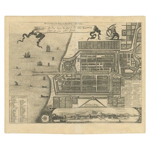
1728 Map of Batavia Castle & City, Java, Van der Aa after 1669
Batavia is now Jakarta.
€880
$985 · £735
Original print, not a reproduction
Ships worldwide from the Netherlands, insured and tracked. 14-day returns.
- Date
- 1728
- Sheet size
- 14.4 × 18.3 in (36.6 × 46.5 cm)
- Condition
- Good. Very good condition for its age. Strong impression on clean paper with wide margins. No staining, tears, or repairs noted. Verso is blank. Very light age toning and minimal handling marks, consistent with careful preservation.
- Island
- Java
- Place names
- Batavia is now Jakarta
- Collection
- Maps and Sea Charts
- Period
- The spice race, before 1700
- Stock no.
- f_45705002
What the condition grades mean
- Excellent
- Bright and clean, with no faults worth mentioning.
- Very good
- Only light signs of age, such as faint toning.
- Good
- Normal signs of age for a sheet of this period: toning, some foxing, small marks or neat old repairs.
- Fair
- Clear faults such as staining, tears or repairs, priced to match.
Every fault we see is written in the condition note, and the whole sheet is shown uncropped in the photos.
1728 Map of Batavia Castle & City, Java, Van der Aa after 1669
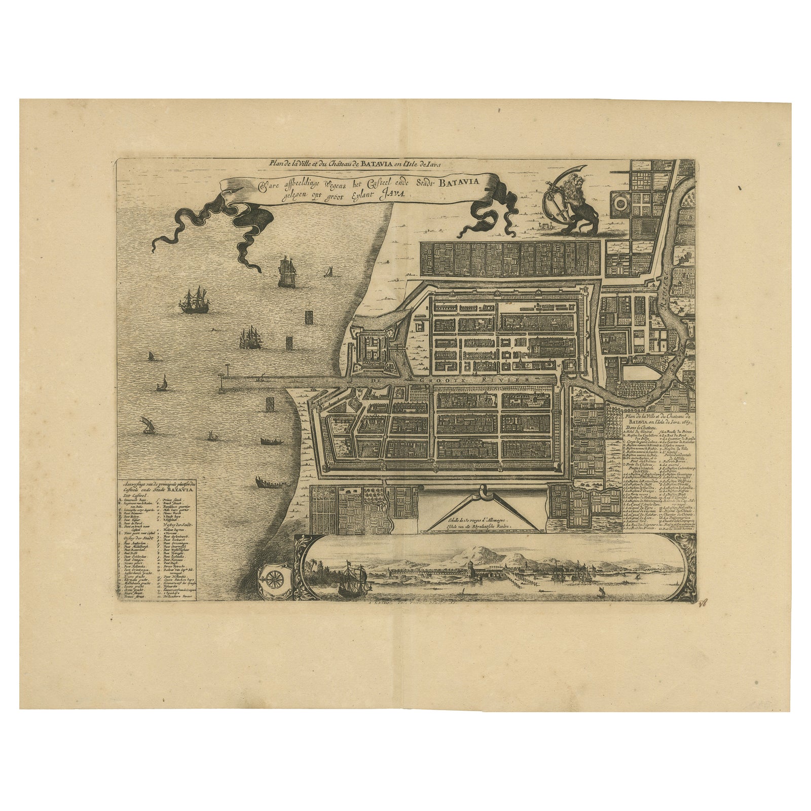
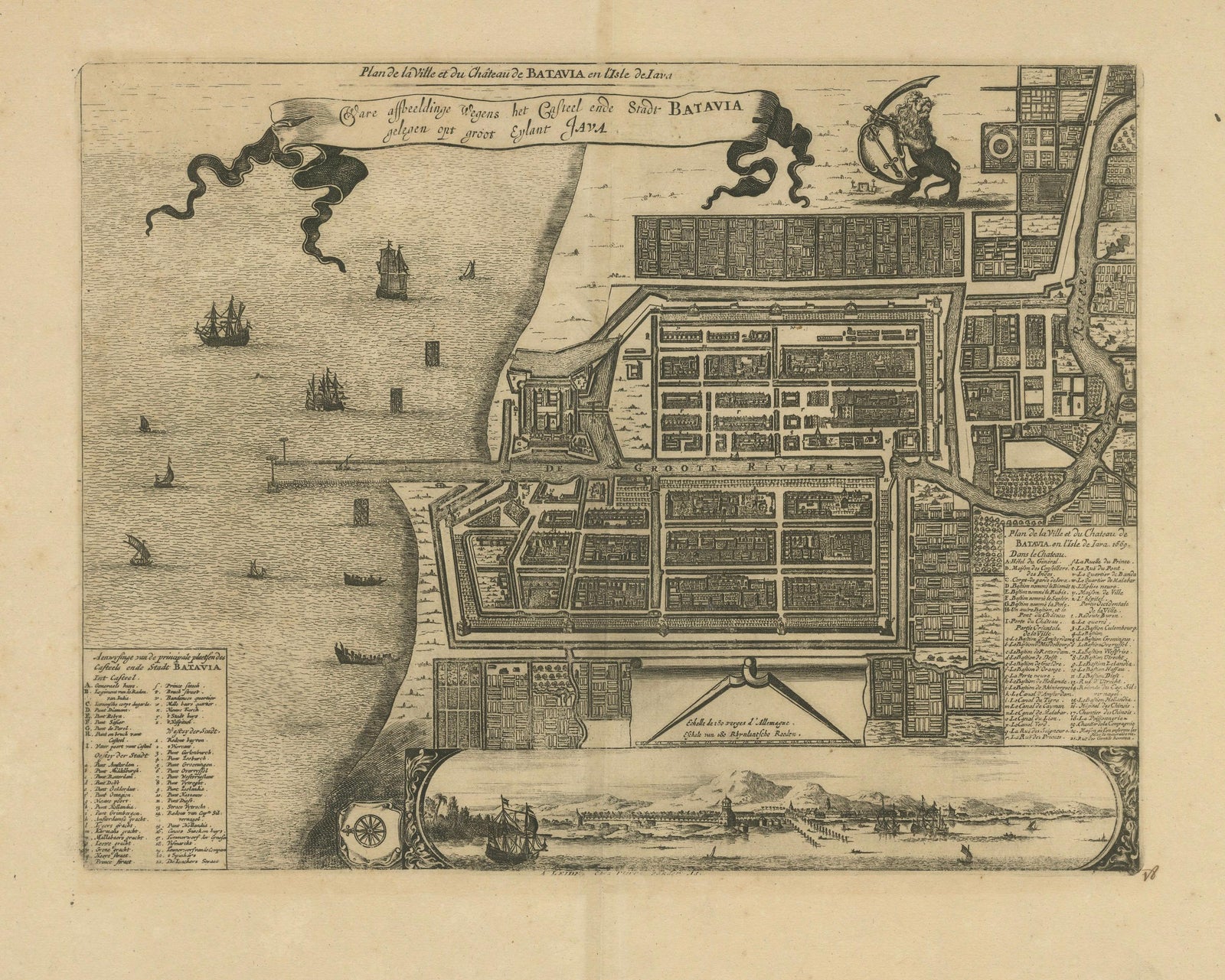
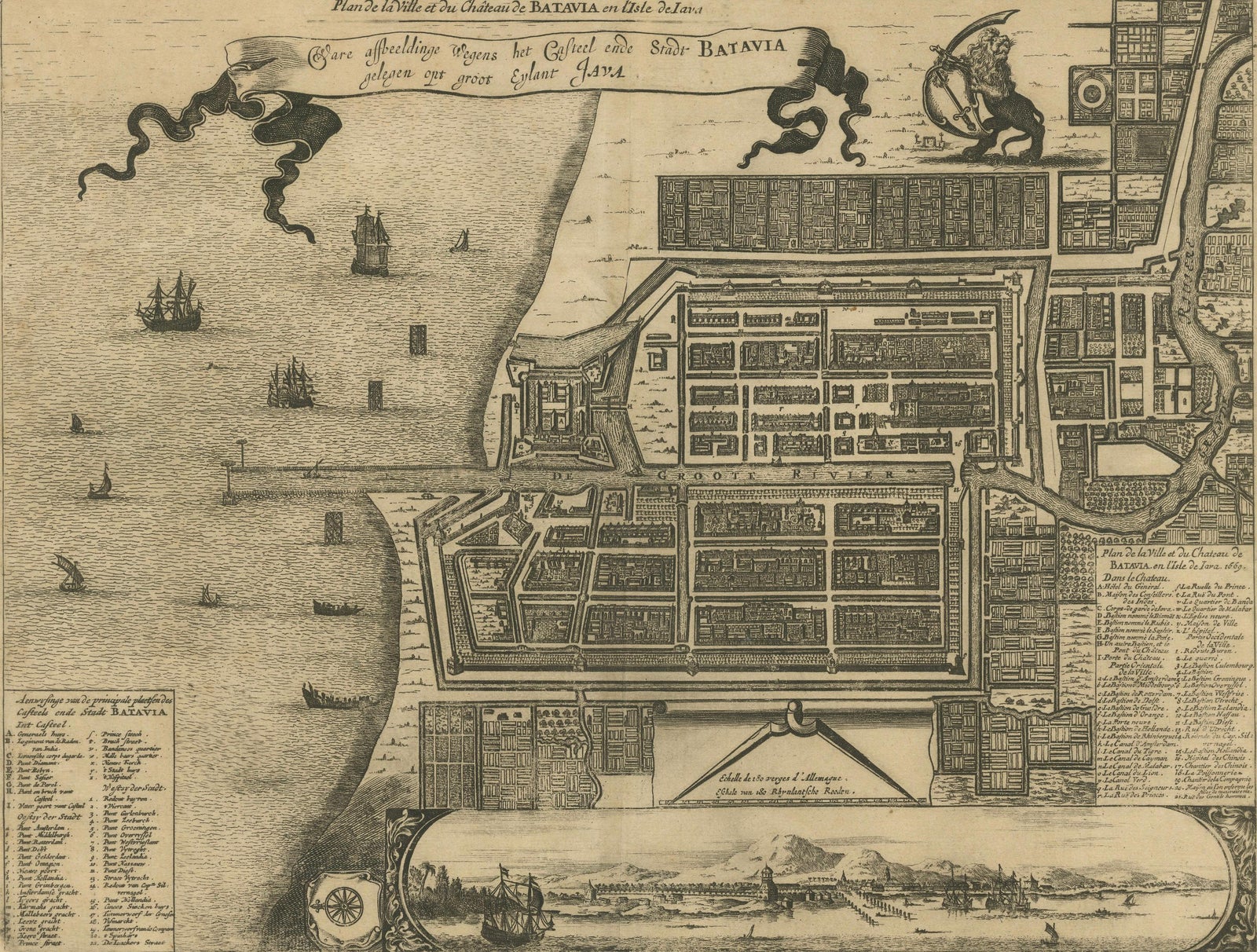
This is an original antique copperplate engraving titled “Plan de la Ville et du Château de Batavia en l’Isle de Iava” by Pieter van der Aa, published in Leiden in 1728. The plan is based on the 1669 original depicting the fortified city of Batavia (modern-day Jakarta, Indonesia) during its peak as the headquarters of the Dutch East India Company (VOC) in Asia.
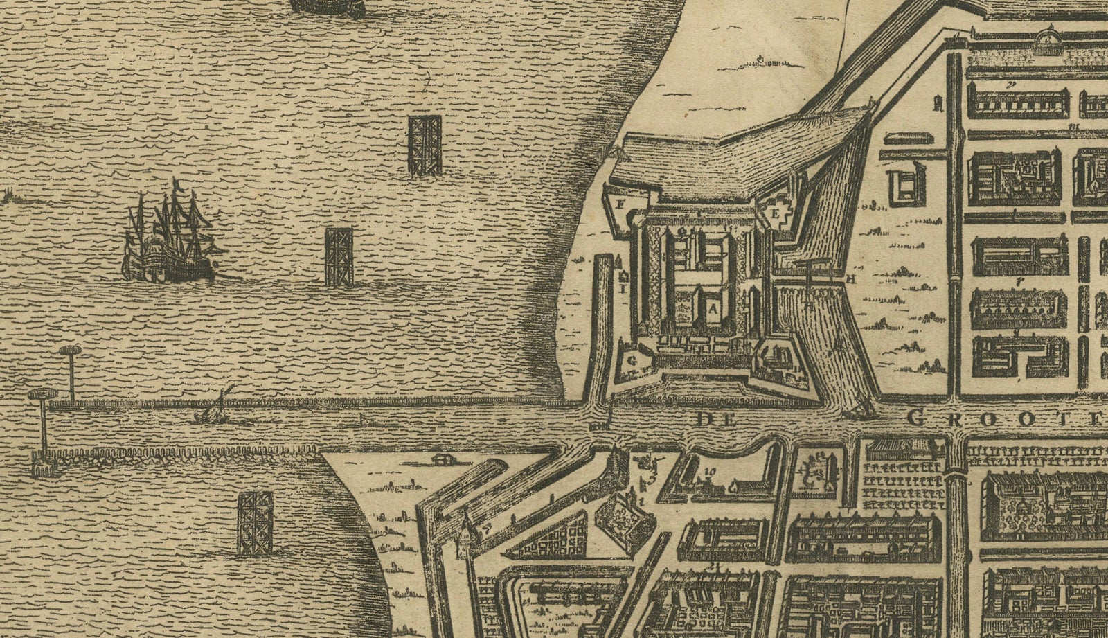
The map shows a detailed bird’s-eye view layout of Batavia, including its robust walls, bastions, canals, and neat grid of streets with labeled buildings and compounds. The castle (Kasteel Batavia) dominates the city’s seaward side, with ramparts extending into the harbor. Ships, junks, and small boats fill the foreground waters, indicating Batavia’s thriving maritime trade.
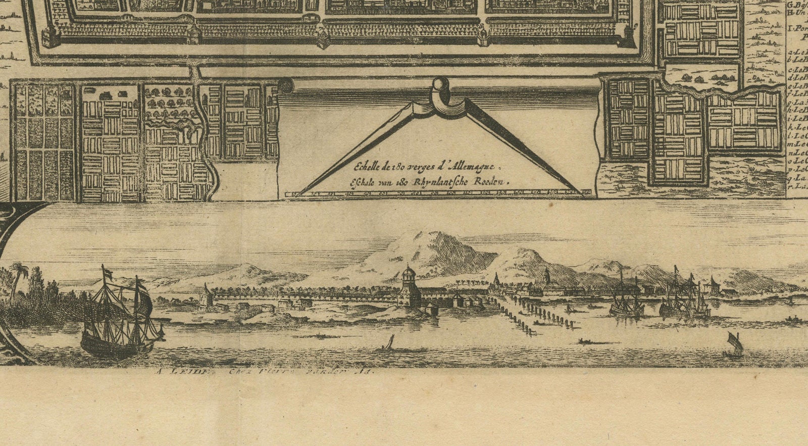
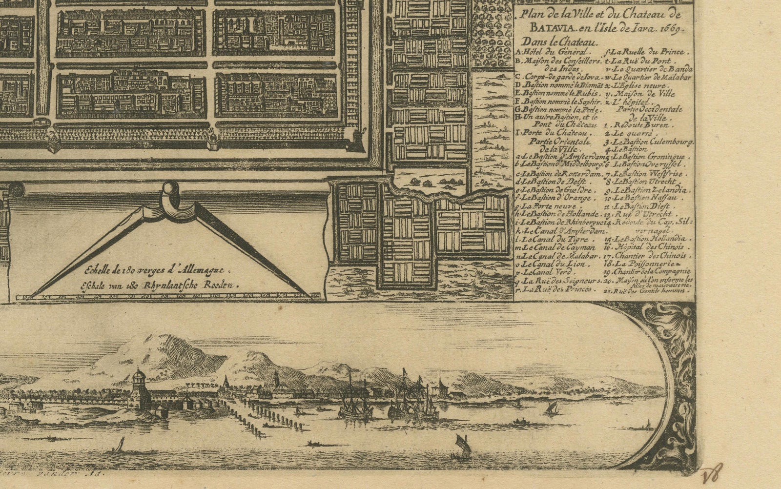
At the lower left and right are extensive keys identifying principal places within the castle and city, written in both Dutch and French. The lower part of the sheet features a finely engraved inset panorama view of Batavia seen from the sea, depicting the fortifications, church towers, and surrounding mountains, framed in an elegant cartouche with a compass rose.
The lion and globe VOC emblem adorns the upper right corner, underscoring Dutch colonial authority and global maritime reach during the 17th and early 18th centuries. Pieter van der Aa (1659 to 1733) was a prolific Dutch publisher known for compiling earlier cartographic works into elegant and collectible atlases.
Very good condition for its age. Strong impression on clean paper with wide margins. No staining, tears, or repairs noted. Verso is blank. Very light age toning and minimal handling marks, consistent with careful preservation. Fully suitable for museum-quality framing.
Framing tips:
Frame this engraving in a slim black, walnut, or gilt frame to enhance its historic and maritime character. Use an off-white archival mat to protect edges and highlight its fine engraving. UV-protective glazing is recommended to preserve the paper and maintain clarity for long-term display.