Close-ups
Framed and on the wall
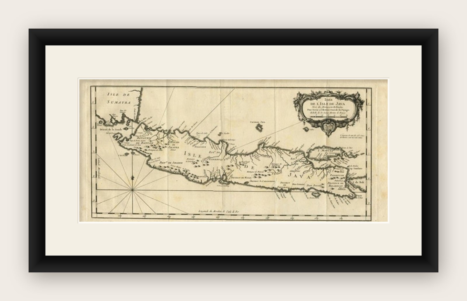

Frame and rooms are illustrations of how the print could look, drawn to its real size; it is sold unframed unless the description says otherwise.
Maps and Sea Charts
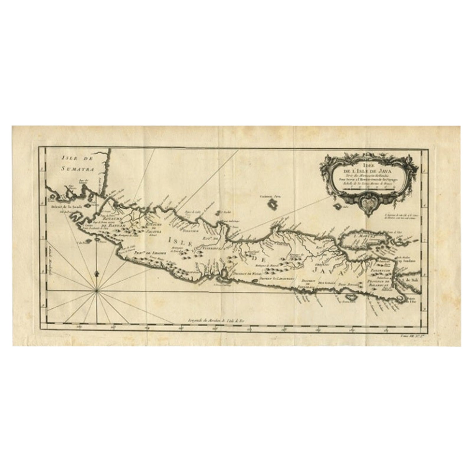
Antique Map of Java and Madura Island, Indonesia, c.1760
€450
$505 · £375
Original print, not a reproduction
Ships worldwide from the Netherlands, insured and tracked. 14-day returns.
- Date
- 1760
- Sheet size
- 19.7 × 9.6 in (50 × 24.5 cm)
- Condition
- Good
- Island
- Java
- Collection
- Maps and Sea Charts
- Period
- The Company, 1700 to 1799
- Stock no.
- f_26361542
What the condition grades mean
- Excellent
- Bright and clean, with no faults worth mentioning.
- Very good
- Only light signs of age, such as faint toning.
- Good
- Normal signs of age for a sheet of this period: toning, some foxing, small marks or neat old repairs.
- Fair
- Clear faults such as staining, tears or repairs, priced to match.
Every fault we see is written in the condition note, and the whole sheet is shown uncropped in the photos.
Antique map titled 'Idee de l'Isle de Java.'
Well engraved and attractive chart of the island shows all principal harbors and coastal details, plus rivers, mountains and volcanoes, bays, the settlements and villages, and political districts. Locates Batavia (Jakarta). Map also includes Madura Island, most of Bali, the Sunda Strait with the Krakatau Islands, and the southeastern tip of Sumatra. The island is divided into provinces and the kingdoms of Bantam, Tsieribon (Cirebon) and Jacatra (Jakatra). Decorated with a very fancy rococo-style title cartouche and rhumb lines with fleur-de-lys. Source unknown, to be determined.
Artists and Engravers: Made by 'Jacques Nicolas Bellin' after an anonymous artist. Jacques Nicolas Bellin (1703, 1772) was a French hydrographer, geographer, and member of the French intellectual group called the philosophes. Bellin was born in Paris. He was hydrographer of France's hydrographic office, member of the Academie de Marine and of the Royal Society of London. Over a 50 year career, he produced a large number of maps of particular interest to the Ministere de la Marine.
Artist: Made by 'Jacques Nicolas Bellin' after an anonymous artist. Jacques Nicolas Bellin (1703, 1772) was a French hydrographer, geographer, and member of the French intellectual group called the philosophes. Bellin was born in Paris. He was hydrographer of France's hydrographic office, member of the Academie de Marine and of the Royal Society of London. Over a 50 year career, he produced a large number of maps of particular interest to the Ministere de la Marine.
Image size: 43 x 20.4 cm.
Explore