Framed and on the wall
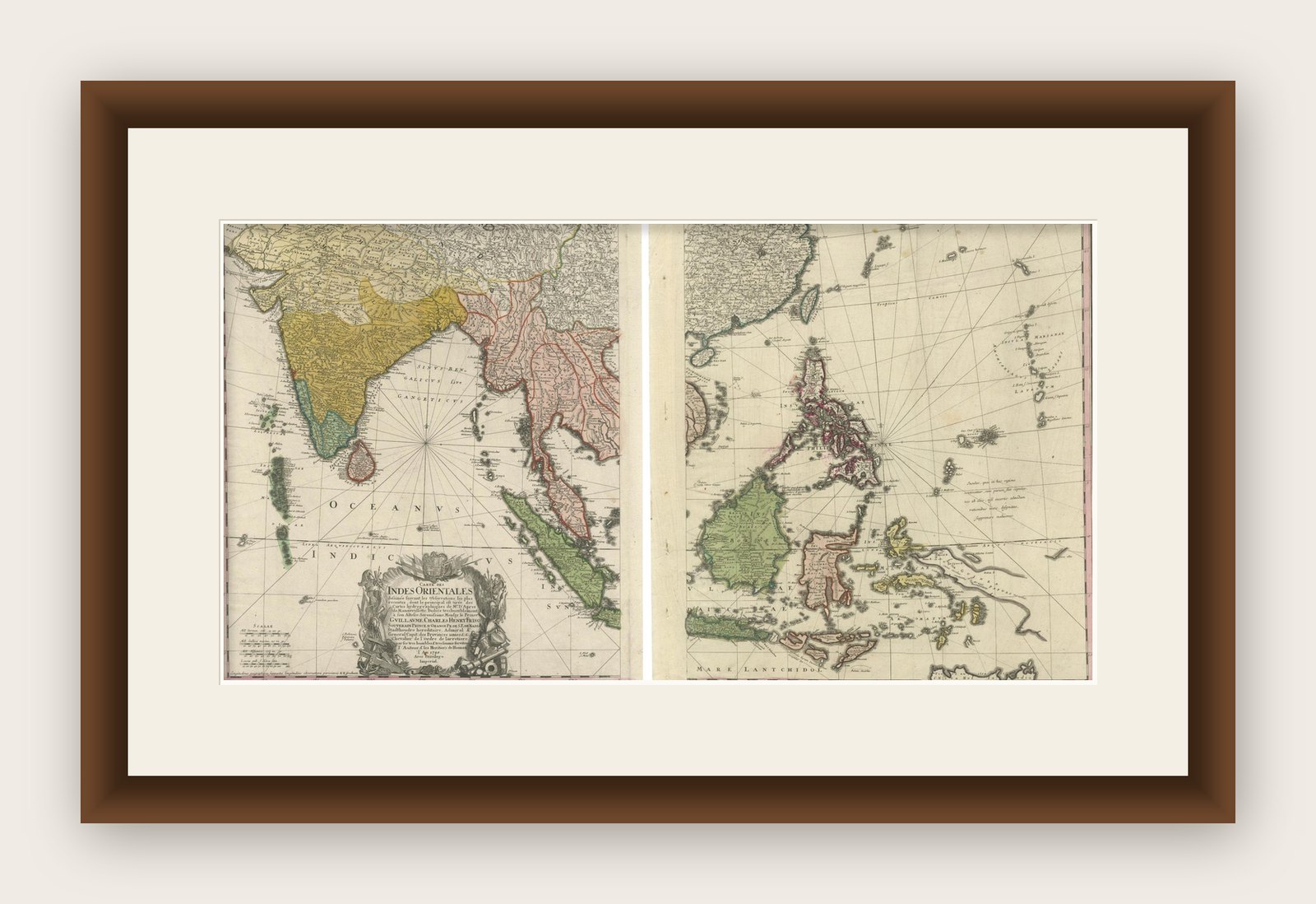
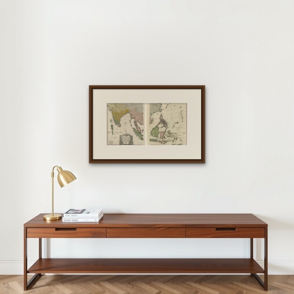

Frame and rooms are illustrations of how the print could look, drawn to its real size; it is sold unframed unless the description says otherwise.
Maps and Sea Charts
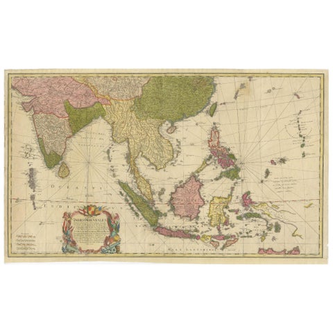
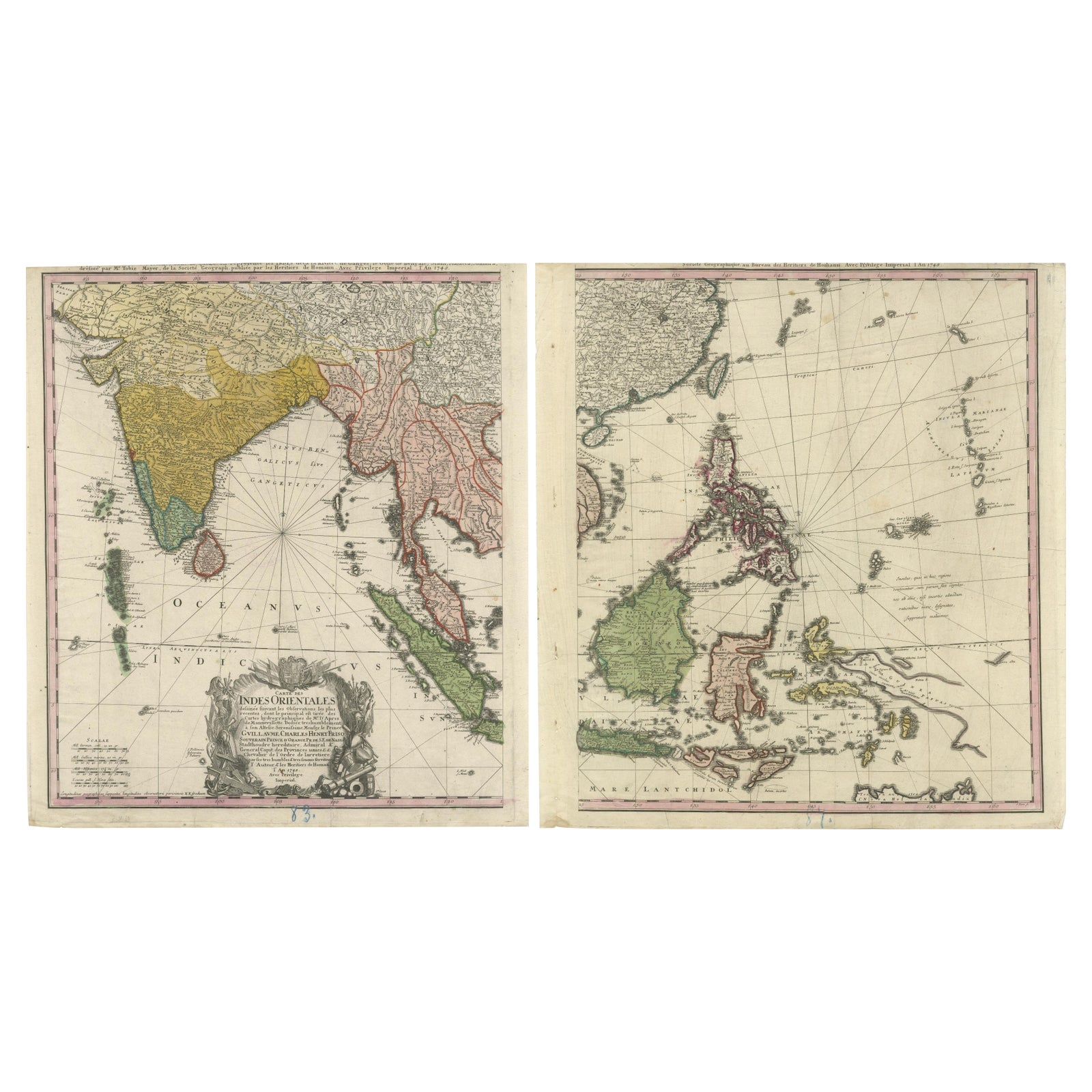
1748 Homann Heirs Double Map of the East Indies and Southeast Asia
£795
$1,065 · €950
Original print, not a reproduction
Ships worldwide from the Netherlands, insured and tracked. 14-day returns.
- Date
- 1748
- Sheet size
- 20.9 × 18.7 in (53 × 47.5 cm)
- Condition
- Fair. Fair condition with crisp engraving and vibrant original hand-coloring. Age-related toning and faint foxing are visible but do not detract from their overall appeal. No tears or repairs noted, but paper showing creases and wear due to handling.
- Collection
- Maps and Sea Charts
- Period
- The Company, 1700 to 1799
- Stock no.
- f_43437762
- Color
- Hand colored
What the condition grades mean
- Excellent
- Bright and clean, with no faults worth mentioning.
- Very good
- Only light signs of age, such as faint toning.
- Good
- Normal signs of age for a sheet of this period: toning, some foxing, small marks or neat old repairs.
- Fair
- Clear faults such as staining, tears or repairs, priced to match.
Every fault we see is written in the condition note, and the whole sheet is shown uncropped in the photos.
Title: 1774 Homann Heirs Double Map of the East Indies and Southeast Asia
Description:
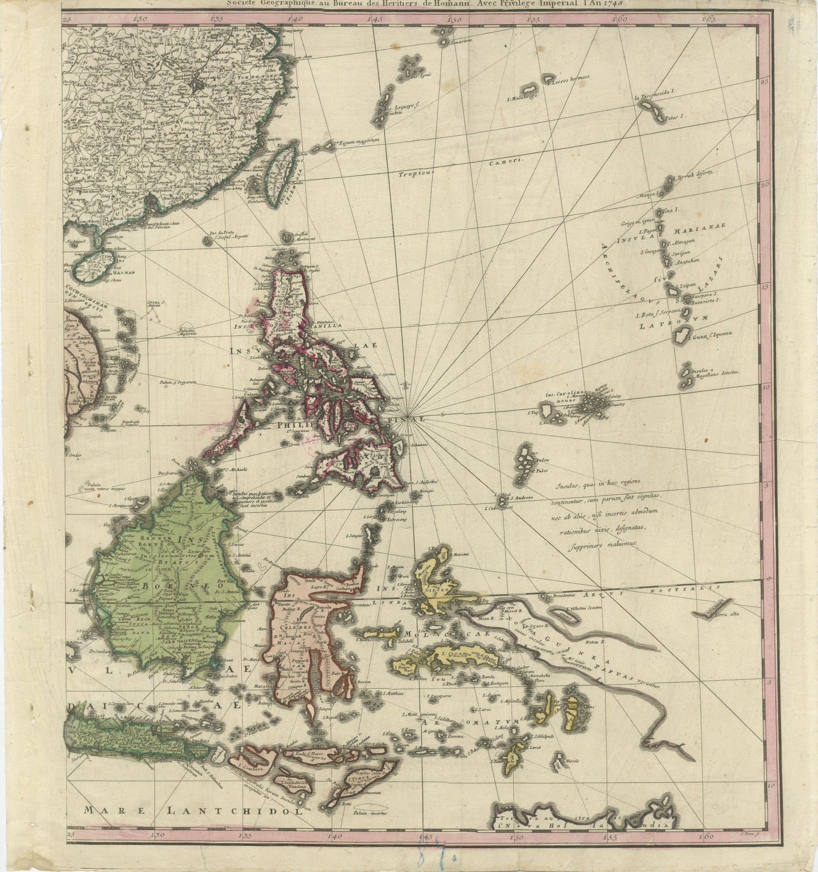
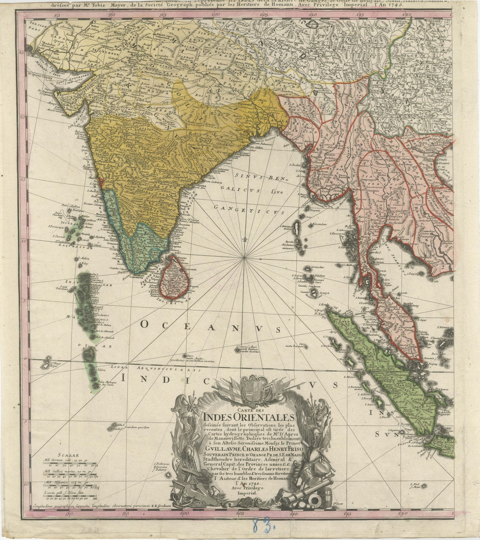
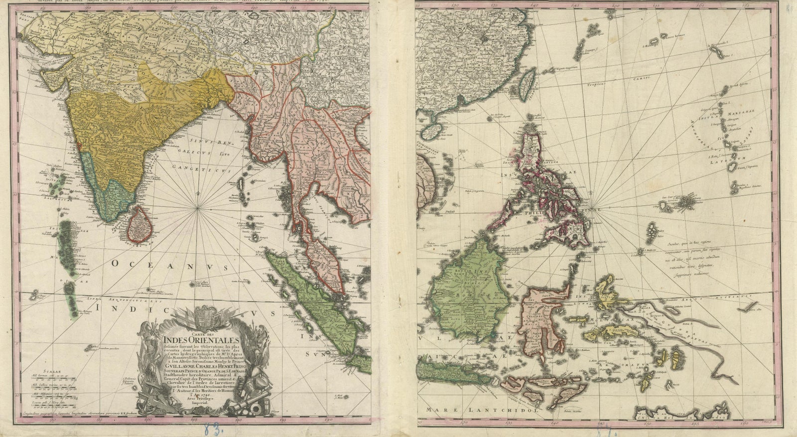
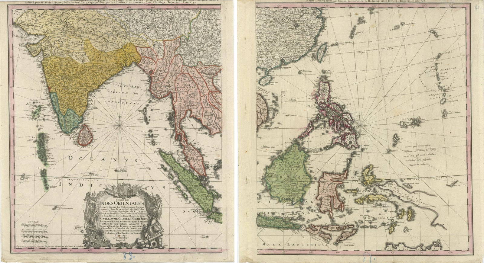
This stunning 1774 double map by the Homann Heirs showcases the East Indies and Southeast Asia, offering a richly detailed view of one of the world’s most significant trade regions during the 18th century. The maps depict the area spanning from India to the Philippines and include prominent features such as the Indonesian archipelago, the Malaysian Peninsula, and parts of China and Japan. The intricate cartography highlights the region’s topography, including islands, coastlines, rivers, and important ports, making it an invaluable tool for historical and geographical study.
The left map features a grand cartouche adorned with allegorical imagery, emphasizing the region's importance in trade and exploration. It covers India and parts of Southeast Asia, with political boundaries carefully marked. The right map focuses on maritime navigation, detailing the Philippines, Borneo, Java, and the surrounding islands. Together, the maps offer a complete picture of the economic and political landscape during the height of European colonial expansion.
These maps were designed by Tobias Mayer and reflect the Homann Heirs’ commitment to accuracy and artistry. The engraved details, combined with original hand-coloring, create a visually striking piece that is both decorative and informative. Collectors and enthusiasts of cartography, maritime history, or colonial studies will find this pair an exceptional addition to any collection.
Condition Report: The maps are in fair to good condition with crisp engraving and vibrant original hand-coloring. Age-related toning and faint foxing are visible but do not detract from their overall appeal. No tears or repairs noted, but paper showing creases and wear due to handling over the last 300 years.
Framing and Matting Tips:
For a cohesive display, stitch the two maps as one composition or frame them side by side. Use a neutral archival mat to emphasize the intricate details, and a dark wooden or antique-style frame to complement their historical aesthetic. UV-protective glass is recommended to prevent fading. Adding a descriptive plaque with the maps' historical context would enhance their appeal as a centerpiece in any room.
Explore